Hiking in Wales
Three National Parks, 870 miles of coastline, and some of Britain's most spectacular mountain walking
Quick Answer — Where Should I Go?
Llanberis Path (Snowdon)
Gradual ascent, clear path, café at summit
Snowdon Horseshoe
Classic ridge walk, stunning views, proper mountain day
Pen y Fan
Free parking nearby, quick summit, iconic views
Waterfall Country
Easy trails, spectacular waterfalls, adventure feel
Tryfan North Ridge
Grade 1 scramble, exposed sections, iconic summit leap
Wales packs more walking variety into its compact borders than anywhere else in Britain. Three National Parks — Eryri (Snowdonia), Bannau Brycheiniog (Brecon Beacons), and Pembrokeshire Coast — offer everything from scrambles up knife-edge ridges to gentle waterfall trails. Add 870 miles of continuous coastal path, ancient pilgrimage routes, and over a dozen peaks topping 3,000 feet, and you've got a lifetime of walking without repeating a step.
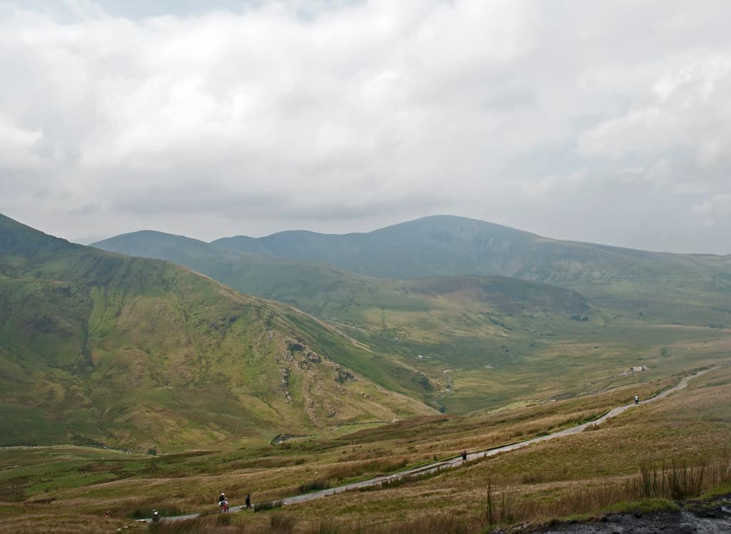
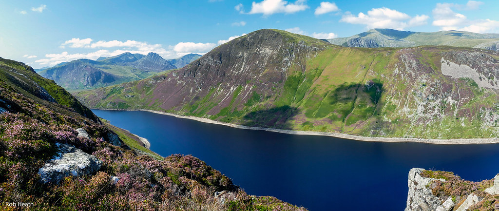
Snowdon draws the crowds — and deservedly so. At 1,085 metres, Yr Wyddfa (its Welsh name) is the highest peak in England and Wales, with six routes ranging from the steady Llanberis Path to the exposed scramble of Crib Goch. But seasoned Welsh walkers know the true magic lies beyond the headlines: Cadair Idris's mystical ridge, Tryfan's rocky tower, the Carneddau's wild ponies, or the haunting beauty of the Cambrian Mountains where you can walk all day without seeing another soul.
The Pembrokeshire Coast Path isn't just Britain's finest coastal trail — it's one of the world's best. 186 miles of dramatic cliffs, hidden coves, and clifftop wildflowers connecting ancient fishing villages. The Brecon Beacons offer a gentler introduction with classic horseshoe routes around Pen y Fan, while the Offa's Dyke Path follows the ancient border for 177 miles of history and landscape.
What makes Welsh walking special isn't just the scenery — it's the accessibility. Unlike the Alps or Highlands, most peaks can be climbed in a day from nearby villages. You can summit Snowdon and be in a pub by teatime. But don't let the convenience fool you: Welsh mountains demand respect. The weather changes fast, paths get rough, and every year Mountain Rescue carries out hundreds of call-outs. Come prepared, and Wales rewards you with experiences that rival anywhere on earth.
Wales's Best Hiking Trails
From gentle walks to challenging scrambles — filter by difficulty to find your perfect route
| Trail | Region | Distance | Difficulty | Duration | Rating | |
|---|---|---|---|---|---|---|
Snowdon Horseshoe (full circuit) Yr Wyddfa (Snowdon) | Eryri (Snowdonia) | 8 miles 1,050m ↑ | Expert | 7-9 hours | 5 | |
Snowdon via Pyg Track Yr Wyddfa (Snowdon) | Eryri (Snowdonia) | 7.5 miles 723m ↑ | Challenging | 5-6 hours | 4.9 | |
Crib Goch Crib Goch / Snowdon | Eryri (Snowdonia) | 7.5 miles 900m ↑ | Expert | 6-8 hours | 4.9 | |
Tryfan North Ridge Tryfan | Eryri (Snowdonia) | 2.5 miles 600m ↑ | Strenuous | 3-4 hours | 4.9 | |
Pen y Fan (Horseshoe) Pen y Fan | Bannau Brycheiniog (Brecon Beacons) | 7.5 miles 600m ↑ | Moderate | 4-5 hours | 4.8 | |
Cadair Idris (Pony Path) Cadair Idris | Eryri (Snowdonia) | 6 miles 850m ↑ | Challenging | 5-6 hours | 4.8 | |
Four Waterfalls Walk | Bannau Brycheiniog (Brecon Beacons) | 5 miles 250m ↑ | Moderate | 3-4 hours | 4.8 | |
Glyder Fach via Miners' Track Glyder Fach | Eryri (Snowdonia) | 6 miles 700m ↑ | Strenuous | 5-6 hours | 4.8 | |
Snowdon via Watkin Path Yr Wyddfa (Snowdon) | Eryri (Snowdonia) | 8 miles 1,015m ↑ | Strenuous | 6-7 hours | 4.7 | |
Pembrokeshire Coast Path (Tenby to Saundersfoot) | Pembrokeshire | 4 miles 200m ↑ | Easy | 2-3 hours | 4.7 | |
Rhossili to Worms Head | Gower Peninsula | 2 miles 100m ↑ | Moderate | 2 hours | 4.7 | |
Snowdon via Llanberis Path Yr Wyddfa (Snowdon) | Eryri (Snowdonia) | 9 miles 975m ↑ | Moderate | 6-7 hours | 4.6 | |
Mawddach Trail (Dolgellau to Barmouth) | Eryri (Snowdonia) | 9 miles 50m ↑ | Easy | 3-4 hours | 4.6 | |
Offa's Dyke Path (Prestatyn to Llandegla) | North Wales | 17 miles 800m ↑ | Strenuous | 8-10 hours | 4.5 | |
Sugar Loaf Mountain Sugar Loaf | Bannau Brycheiniog (Brecon Beacons) | 4 miles 350m ↑ | Easy | 2-3 hours | 4.5 |
Snowdon Horseshoe (full circuit)
Snowdon via Pyg Track
Crib Goch
Tryfan North Ridge
Pen y Fan (Horseshoe)
Cadair Idris (Pony Path)
Four Waterfalls Walk
Glyder Fach via Miners' Track
Snowdon via Watkin Path
Pembrokeshire Coast Path (Tenby to Saundersfoot)
Rhossili to Worms Head
Snowdon via Llanberis Path
Mawddach Trail (Dolgellau to Barmouth)
Offa's Dyke Path (Prestatyn to Llandegla)
Sugar Loaf Mountain
Find Trails Near You
Click markers to see trail details
Explore by Region
Each region offers a unique walking experience
Eryri (Snowdonia)
Home of Wales's highest peaks and most dramatic mountain scenery
Bannau Brycheiniog (Brecon Beacons)
Southern Britain's highest peaks with waterfalls, caves, and dramatic escarpments
Pembrokeshire Coast
186 miles of world-class coastal walking — Britain's only coastal National Park
Gower Peninsula
Britain's first AONB with dramatic cliffs, beaches, and tidal islands
Mid Wales
Remote hills, reservoirs, and the wild Cambrian Mountains
North Wales
Historic trails, border walking, and the gateway to Snowdonia
Trail Difficulty Grades
Know before you go — choose a grade that matches your experience
Well-maintained paths on gentle terrain. Suitable for families and beginners. Minimal navigation required.
Clear paths with some steeper sections and uneven ground. Good fitness required. Basic navigation helpful.
Steep, rough paths requiring stamina and sure-footedness. Navigation skills needed. Some exposed sections possible.
Long, demanding routes with significant ascent. Rocky terrain, steep descents. Experience and fitness essential.
Grade 1+ scrambling with serious exposure. Hands required. One slip could be fatal. For experienced mountaineers only.
When to Visit
Plan your trip around the seasons for the best conditions
Spring
Unpredictable weather with mixed sun, rain, and occasional snow on high peaks. Warming temperatures (8-16°C). Wildflowers emerging. Quieter trails before summer rush.
May is ideal — longer days, warming weather, wildflowers in bloom. Higher peaks may still have snow patches. Pack layers for variable conditions.
Summer
Warmest and driest (12-21°C). Longest days (up to 17 hours). Best conditions for high mountain routes. Busiest period, especially Snowdon.
Start early to beat crowds on popular routes. Pen-y-Pass car park fills by 8am. Consider lesser-known alternatives like the Carneddau or Rhinogydd.
Autumn
Cooling temperatures (10-16°C). Spectacular autumn colours in valleys. Shorter days. Weather becoming more changeable. Fewer crowds.
September is one of the best months — summer warmth lingers, crowds thin, and the light is magical. October brings stunning colours. Check sunset times.
Winter
Cold (above freezing in valleys, below on peaks). Snow and ice on high ground. Shortest days (8 hours). Many routes become winter mountaineering.
Low-level walks are fine but high peaks require winter gear (crampons, ice axe) and experience. Pen y Fan and Snowdon become icy deathtraps for the unprepared. Beautiful when conditions are right.
Mountain Safety Essentials
Essential Safety Rules
- Check weather forecast before setting out (Mountain Weather Information Service)
- Tell someone your route and expected return time
- Start early — allow plenty of daylight
- Carry map and compass; know how to use them
- Turn back if conditions deteriorate or you're unsure
- Pace yourself for the slowest group member
- Never rely solely on a phone for navigation
- Watch for signs of hypothermia in your group
🆘 Emergencies
In emergency: call 999, ask for Police, then Mountain Rescue. Give your grid reference (use OS Locate app if unsure). Stay put unless in immediate danger. Use whistle (6 blasts per minute) to attract attention.
⛰️ Mountain Rescue
Llanberis Mountain Rescue Team is the busiest in Wales with 200+ call-outs annually. Most incidents are avoidable: poor preparation, underestimating routes, or attempting walks beyond experience levels. Be honest about your abilities.
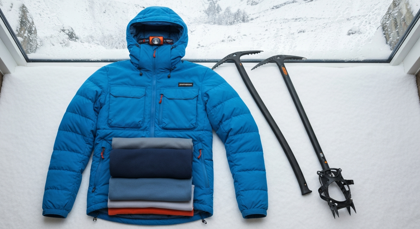
What to Pack
Essential kit for Welsh mountain walking
Essential Kit (All Walks)
❄️ Winter Additions
👟 Footwear Guide
National Trails in Wales
Wales Coast Path
The world's first continuous national coastal path. Circumnavigates the entire Welsh coast from Chester to Chepstow.
Offa's Dyke Path
Follows the ancient Anglo-Welsh border. Historic sites, rolling countryside, and spectacular views from the Clwydian Range.
Glyndŵr's Way
Named after Welsh hero Owain Glyndŵr. Links Knighton to Welshpool through the wild heart of Mid Wales.
Book Guided Walks
Expert-led walks, navigation courses, and mountain experiences

Hill Walking & Hiking
Snowdonia
Hill Walking & Navigation Courses
Snowdonia
Llanberis Path Guided Walk
Snowdonia
Snowdon Summit Hike
Snowdonia
Walking Trails
Snowdonia
Walking Events & Festivals
The HOWUM HALF 2026
Heart of Wales
Trail RunningRadyr Trail Races
Radyr, Cardiff
Trail RunningTenacious Ten Endurance Challenge
Brecon Beacons
Trail RunningLlangollen Trail 10K & Kids 1 Mile Race
Llangollen
RunsPembrokeshire Coastal Races - Trail and Ultra Running Festival
Dale Hill farm camping
RunsWelsh 1000m Peaks Race
Snowdonia
Fell RunningWalking Trip Itineraries
Multi-day adventures featuring the best of Welsh walking
48 Hours of Adrenaline
Non-stop thrills across North Wales
Adrenaline Junkie Weekend
Maximum thrills in minimum time
Anglesey Coastal Path Highlights
The best sections of the 125-mile loop
Beginner's Adventure Taster
Your first taste of Welsh adventure
Combine Hiking With...
Make the most of your Welsh adventure with these perfect pairings
Hiker-Friendly Accommodation
Find places to stay near Wales's best walking trails