Navigation Skills for Welsh Mountains
Navigating the Welsh mountains isn't just about reaching the summit; it's about getting back down safely, knowing what to do when the clag rolls in, and understanding the landscape under your boots. This guide covers essential navigation skills for hiking in Wales, focusing on practical techniques and real-world scenarios.
Navigation Skills for Welsh Mountains
Whether you’re tackling Snowdon (Yr Wyddfa) via the Llanberis Path or exploring the less-trodden trails of the Brecon Beacons, solid navigation skills are non-negotiable. Relying solely on your phone is a recipe for disaster. Batteries die, screens crack, and signal vanishes faster than a pasty at a rugby match. This guide assumes you’re serious about staying safe and self-reliant in the hills.
The Bare Minimum: Map and Compass
Forget fancy gadgets for a moment. A proper Ordnance Survey map (1:25,000 scale is best) and a decent compass are your foundation. The OS Explorer series covers the whole of Wales. Get the laminated versions; they’re worth the extra few quid. Expect to pay around £12-£15 per map.
- OS Explorer OL17 covers Snowdonia
- OS Explorer OL13 covers Brecon Beacons National Park (Eastern Area)
- OS Explorer OL12 covers Pembrokeshire Coast National Park
The compass should have a rotating bezel, a clear baseplate, and preferably a sighting mirror. Suunto and Silva are reliable brands. Don’t skimp here; a basic compass costs around £25-£40, but it's an investment in your safety.
Understanding Map Features
Before you even think about setting foot on a trail, learn to read a map. Contour lines are your friends. They tell you about the steepness of the terrain. Close lines mean steep slopes; wide lines mean gentle slopes. Learn to visualise the landscape from the contours. Practice in your garden, local park, or even just by looking at maps online.
Key features to identify:
- Contours: Elevation and terrain steepness.
- Grid lines: Used for referencing locations and plotting bearings.
- Paths and tracks: Not all are accurate, especially in remote areas.
- Water features: Rivers, streams, lakes – crucial for planning and emergencies.
- Buildings and structures: Walls, fences, ruins can all be useful landmarks.
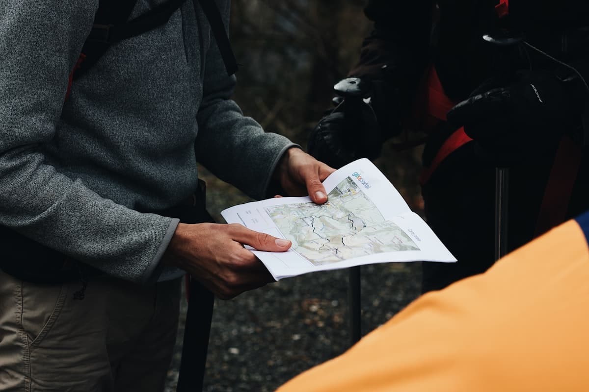
Mastering Bearings
Taking a bearing is a fundamental skill. Here’s a quick refresher:
1. Orient the map: Align the map with the ground using the compass. Place the compass on the map, aligning the north end of the compass housing with north on the map (grid north, not magnetic north - more on that later). Rotate the map until the compass needle points to north on the compass housing.
2. Identify your location and destination: Find your current location and your intended destination on the map.
3. Place the compass: Place the edge of the compass baseplate along the line connecting your current location to your destination.
4. Rotate the bezel: Rotate the compass housing until the orienting arrow aligns with grid north on the map. Make sure you are aligning the north end of the orienting arrow with north on the map.
5. Account for magnetic declination: This is where things get slightly trickier. Magnetic north isn't the same as grid north. The difference is called magnetic declination. In Wales, it's currently around 2-3 degrees West, meaning magnetic north is a few degrees west of grid north. You need to add this to your bearing when navigating from the map to the ground. Many compasses have an adjustable declination, but honestly, just remembering to add a couple of degrees is usually sufficient. Forget this, and you'll end up consistently off course.
6. Follow the bearing: Take the compass off the map, hold it level, and turn your body until the north end of the compass needle aligns with the orienting arrow. The direction of travel arrow on the compass baseplate now points toward your destination. Pick a landmark in that direction and walk towards it. Repeat the process as needed.
Practice this. A lot. Don't wait until you're lost in a Snowdonia whiteout. Use online resources or take a navigation course with Plas y Brenin in Capel Curig to hone your skills. Expect to pay £150-£300 for a weekend course.
GPS and Phone Apps: Useful, But Don't Rely On Them
GPS devices and phone apps like OS Maps or ViewRanger can be useful tools, but they should supplement your map and compass skills, not replace them. They are prone to failure due to battery drain, signal loss, or damage.
- Carry a power bank: Essential for longer hikes.
- Download offline maps: Don't rely on mobile data.
- Protect your phone: A waterproof case is a must.
- Know how to use the app: Practice before you need it.
Personally, I use OS Maps on my phone, but I always have a paper map and compass as backup. It has saved my skin on more than one occasion, especially when scrambling in poor visibility. I once relied on my phone on Tryfan, and the battery died halfway down. It's a steep mountain even with good visibility!
Common Navigation Errors and How to Avoid Them
- Not accounting for magnetic declination: As mentioned above, this is a common mistake. Double-check your bearings and always adjust for declination.
- Misidentifying features: Be absolutely certain you know what you're looking at. Is that stream the one on your map? Are you sure?
- Losing concentration: Navigation requires constant attention. Don't let fatigue or distractions lead you astray.
- Ignoring the weather: Weather in the Welsh mountains can change rapidly. Whiteouts, heavy rain, and strong winds can make navigation extremely difficult.
- Being too proud to admit you're lost: If you're unsure of your location, stop, reassess, and backtrack if necessary. Don't keep blindly walking in the wrong direction.
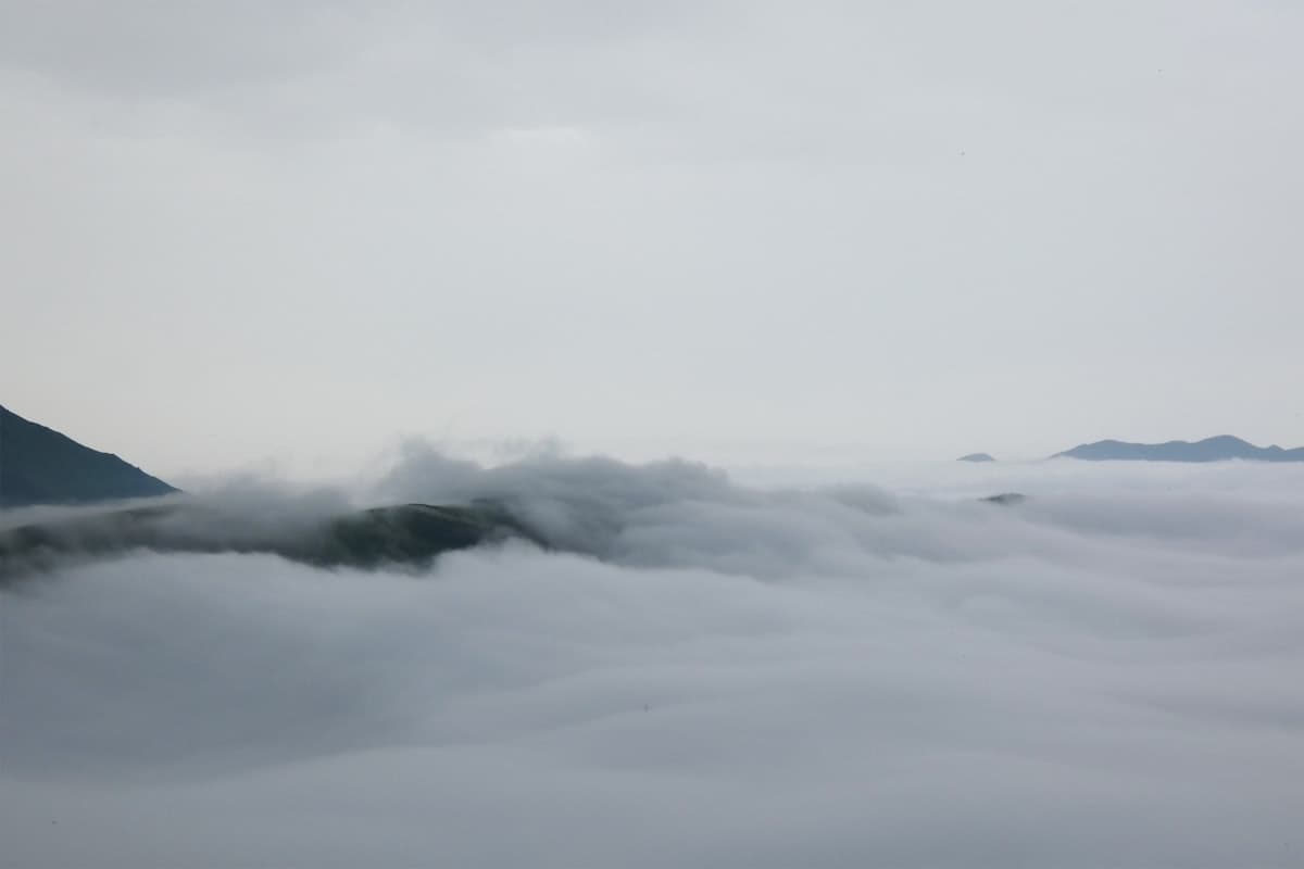
Dealing with Poor Visibility
This is where your navigation skills will be truly tested. When the cloud descends, everything looks the same.
- Reduce visibility errors: Use your compass often and take frequent bearings to ensure you are on the right path.
- Follow paths accurately: Even in clear conditions, stick to the correct path or trail.
- Use timing and pacing: This is critical in poor visibility. Know how long it takes you to walk a certain distance on different types of terrain. Use this to estimate your location.
- Consider changing plans: If the conditions are too severe, turn back. There's no shame in admitting defeat. The mountains will still be there tomorrow.
Walking Snowdon in thick fog is a completely different experience from a clear day. Consider booking a guided walk with MountainXperience (from £45) or Snowdonia Mountain Guides (from £60) if you're not confident navigating in poor visibility.
Essential Gear
Besides a map and compass, consider these essential items:
- Headlamp: Even if you plan to be back before dark, carry a headlamp. Accidents happen. Petzl and Black Diamond are good brands.
- Whistle: Six short blasts is the international distress signal.
- Waterproof clothing: Essential in Wales. Seriously.
- Emergency shelter: A lightweight bothy bag can be a lifesaver in bad weather.
- First-aid kit: Know how to use it.
- Food and water: Carry enough for the entire day, plus extra in case of emergencies.
- Fully charged mobile phone (in a waterproof case): As a backup, not a primary navigation tool.
Stay Safe, Have Fun
Navigating the Welsh mountains can be challenging, but it's also incredibly rewarding. With the right skills and preparation, you can explore some of the most beautiful landscapes in the UK safely and confidently. Remember to respect the mountains, be aware of the risks, and never overestimate your abilities.
And don't forget to tell someone where you're going and when you expect to be back. Mountain Rescue Cymru are volunteers, and they'd rather help you prevent an accident than rescue you from one.
For a different type of adventure, consider exploring the coast with TYF Adventure in Pembrokeshire and try some coasteering, or head south to the Brecon Beacons for some gorge-walking with Adventure Britain. Navigation skills are useful there, too, just in a different context.